On the Development of Spatial/Temporal Solar Radiation Maps: A Minas Gerais (Brazilian) Case Study ()
1. Introduction
The knowledge of the solar resource is important for increasing the production and promoting the widespread use of solar energy for energy purposes. The accuracy of spatial or temporal solar irradiation knowledge enables us to add reliability (lower risk) and quality to the solar systems, which are reflected in the costs of the energy generated. The solar resource is required for the project of solar systems in three main aspects: 1) Sitting study of the solar power plants (sitting); 2) Prediction of the annual, monthly, or daily production of the energy generated; and 3) Solar irradiation forecasting and operational strategies.
In the sitting studies of large solar power plants, amongst others, the following variables are considered: solar resource (direct or global, depending on the solar technology used: fixed or with concentration), availability of land that can be utilised in a non-confrontational way (agricultural land, reserves or national parks, Indian reservations are excluded), proximity of access routes for transporting delicate or large equipment (mirrors), local availability of good-quality water, and the proximity of transmission lines. Individually, the knowledge of the solar resource is the major variable in the uncertainties associated with a solar energy system project.
The prediction of the annual energy production, which is made considering the inter-annual stochastic variability of solar radiation, is crucial for calculating the cost of the energy generated and directly affects the economic viability of the enterprise. The seasonal calculations are important to trace the operational and integration strategies of the energy system, e.g., the complementarily of wind energy and solar energy with hydropower of the San Francisco River Basin. On a shorter time scale (hours), wind energy and hydropower subsidize strategies of storage systems. After the construction of the solar plant, the stage of commissioning and acceptance of the plant requires operational testing (at least of short duration) to verify that the plant is within the specifications and parameters of the project and to infer the annual energy production. During the lifetime of the plant, the solar radiation should be monitored continuously and its performance should be calculated simultaneously to detect possible performance drops due to component aging (loss of reflectivity in the reflecting mirrors, vacuum in the collecting ducts, or the depletion of the protective layer of photovoltaic cells) or the need for cleaning (washing the mirror surface or PV module).
Minas Gerais is the fourth unit of the federation in territorial extension, with an area of 586,528 km2, which corresponds to 7% of the territory of the country. The state is located between the parallels 14˚13'58'' and 22˚54'00'' south latitude and the meridians 39˚51'32'' and 51˚02'35'' west of Greenwich. Its positioning in relation to Brazil is shown in Figure 1.
Data from the Demographic Census [1] reveal that the population of Minas Gerais in 2010 was 19,597,330, of which 16,715,216 people lived in the urban area and 2,882,114 in the countryside. Thus, the degree of urbanization of Minas Gerais was 85.29% in 2010. The state population consisted of 9,641,877 men and 9,955,453 women.
Currently, Minas Gerais has 318 enterprises of electricity generation in operation, generating 19,221,480 kW of power. In the coming years, the state will have an additional 1,435,795 kW in generation capacity as a result of 12 projects currently under construction, and 72 more projects have been granted. Table 1 and Table 2 shows the number and power, respectively, of the CGH (Central Hydroelectric Generator), SHP (Small Hydro), HPP (Hydro Power Plant), and TPP (Thermal Power Plant) in operation and under construction in the state of Minas

Figure 1 . Location of the state of Minas Gerais in Brazil. Source: Landsat 7
Itemized MRI cost.
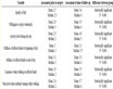
Table 1 Enterprises of electric power generation in operation in the state of Minas Geraisa.
Table 2.Enterprises of electric power generation under construction in the state of Minas Geraisa.
aSource: ANEEL, 2011.
Gerais. Moreover, the state has a wind and a solar power plant that will be installed in Sete Lagoas.
CEMIG, as the main state concessionaire, distributes power to 805 of the 853 Minas Gerais Municipalities, which represents managing a distribution network larger than 400 thousand km in length that is considered the largest in Latin America.
2. Methodology
2.1. Mapping Process
The flowchart for the preparation of solar irradiation and insolation maps for the state of Minas Gerais are shown in Figure 2.
The phases of data collection and search and data analysis and systematization were the most arduous of the project. The work consisted of the collection, location, and search for publications containing radiation data, insolation solarimetric maps, climatological maps, and phytogeographic information of Minas Gerais and neigh-

Figure 2. Flowchart for the elaboration of maps of solar radiation and insolation. Source: Solarimetric Atlas of Brazil (2001).
bouring states. Such information was dispersed geographically, temporally, and institutionally in places such as the Department of Agriculture, Meteorological Districts, Universities, and Energy institutions, amongst others. Because of the need of the greatest spatial and temporal coverage, databases with information obtained from sensors of different accuracy classes of different spatial coverage and different measurement periods were considered, analysed, and made consistent. Such information was organised to form a database.
Then, information about the insolation maps, the global solar radiation and other meteorological variables were spatially interpolated and visualised through maps. Twelve monthly maps, an annual map, and another map with the location of the measurement stations were created.
2.2. Collection and Assessment of the Solarimetric Data
The main criteria for the assessment of solarimetric data were: the quality of the sensors, the measurement periods, and the spatial distribution of the measurements.
2.2.1. Qualification of the Sensors
The Campbell - Stokes type heliographs, Figure 3, produce information about the daily insolation. In these devices, the convergence of the solar rays on a strip of paper burns throughout the day, and the length of the burn is used to quantify the sun shining hours. The burning occurs when the direct solar radiation exceeds a variable threshold from 100 to 200 W/m2, which depends on the geographical location of the equipment, on the climate, and on the type of paper strip used to perform the recording. When the equipment is installed properly, with the use of an appropriate paper strip, the threshold is equal to 120 W/m2. By using simple correlations with the appropriate coefficients, the historical series of insolation can be used to estimate daily, monthly, or annual solar radiation rate, with minimum errors of approximately 10%.
The pyranometers are devices intended to measure the global and diffuse solar radiation. There are different types of pyranometers, but here, only the thermoelectric and photovoltaic pyranometers are considered, as shown in Figure 4(a) and Figure 4(b), because most of the equipment installed in Brazil are of these types. The sensitive element of a thermoelectric pyranometer is a thermoelectric battery (set of thermocouples connected in series). The hot junction of thermopile is in contact with the surface of a detector (surface exposed to solar radiation). The photovoltaic pyranometer uses a photodiode as a sensor; however, those are less accurate in addition to having a limited spectral response (400 - 1100 nm). The pyranometers are classified into various classes, as presented in Table 3. The vast majority of instruments used for field measurements in Brazil are of the second class (Photovoltaic sensor).
These pyranometers attached to electronics integrators perform measurements of the daily global solar radiation with the errors described in Table 4; all the maintenance and periodical calibration procedures (at least once a year) are followed.

Figure 3. Campbell—Type Stokes Heliograph. Source: Solarimetric Atlas of Brazil (2001).
 (a)
(a) (b)
(b)
Figure 4. Types of pyranometers installed in solarimetric stations. Source: Solarimetric Atlas of Brazil (2001).
2.2.2. Measurement Period
A central problem associated with the solar resource assessment consists of estimating the smallest number of years necessary to obtain a reliable estimate of the solar radiation in a specific place. Studies performed [2] with the purpose of using insolation measures (sunshine hours) to determine the global solar radiation using the Angstrom relation have estimated the number of necessary years for a reliable determination of the solar resource.
The authors concluded that a 14-year period enables a daily series to be statistically stable not only for insolation data and its conversion to radiation but also for other meteorological variables. In other words, for periods longer than 14 years, it is believed that the observed variability, in this case of the solar resource, is due exclusively to its intrinsic statistical nature, regardless of the sample size. Obviously, in geographic regions of strongly variable climatology, this consideration is not valid.
2.2.3. Spatial Distribution of the Measures
Generally speaking, the solarimetric information, even the most abundant information, such as the daily insolation, does not satisfy all of the requirements of its users, due to the low density of the station nets. Recent studies on the spatial variability of the solar resource in homogeneous phytogeographic regions indicate that the global daily radiation and the monthly average can be extrapolated out to 200 km of distance with errors of 15%, with a confidence level of 90% [3] .
In geographic regions with a strongly variable topography, such as mountains and large water mirrors (the coast), the cited extrapolation is not valid. The theme of the spatial extrapolation of solar radiation is not yet sufficiently studied due to the lack of good quality data and the small numbers of the sites measured.
2.2.4. Angstrom Relation
The relationship between the monthly averages of the daily insolation and the daily global solar radiation is Table 3. Classification of the pyranometers sensors according to the WMOa.
aSource: WMO, 2010.
Table 4. Comparasion of daily solar radiation data, monthly averages for different locations in the world and Brazil.