Effect of Recharge and Irrigation on the Variation of Nitrate in the Groundwater of Wadi Djendjen (Jijel—North-East Algeria) ()
1. Introduction
The agricultural pollution is a major cause of the deterioration of groundwater quality [1]. Agricultural activities are probably the most significant anthropogenic sources of nitrate contamination in groundwater (Carey and Lloyd, 1985; De Simone and Howes, 1998) [2,3]. The development of agricultural land and the requirements of a good production require an input of fertilizers which often leads to groundwater pollution by nitrates due to their high solubility and their weak affinity for ionic exchanges (Macko and Ostrom, 1994; Stumm and Morgan, 1996) [4,5].
Many studies proved that husbandries are the probable cause of the excessive nitrate levels in the groundwater (Lake et al., 2003; Mitchel et al., 2003; Carey, 2002) [6]. Concentrations raised out of nitrates in drinking water are related to health issues such as the methemoglobinemy for children and the cancer of the stomach for adults (Wolfe and Patz, 2002; Hall et al., 2001) [7,8]. There exist values of limiting acceptable nitrate concentration in drinking water. WHO to define an obligatory limiting value fixed at 50 mg/l [9].
Thus, in the plain of the wadi Djendjen, the increase in the contents of nitrates of the groundwater found in certain zones, is related to surpluses of manures brought to the cultures. To address this question, a monthly sampling of groundwater for chemical analysis was carried out during 3 consecutive years in four wells distributed in terms of the use of land, the use of fertilizer and the frequency of irrigation.
2. Presentation of the Study Area
The area of the study is located in the north-east of Algeria. The alluvial aquifer of this area forms part of the coastal plains region of Jijel (Figure 1); it covers an area of 58 km2 and opens to the north of the Mediterranean Sea. It corresponds to the lower part of wadi Djendjen and its tributaries which contribute to the groundwater recharge.
The maritime location of this plain gives it a mild and damp climate. Between the winter and summer, the monthly median values of temperatures vary from 11 with 25˚C (the average air temperature is 17˚C/year), the humidity relative from 70% to 75% and the evaporation

Figure 1. Location map of the study area.
from 41 to 80 mm. The rainfall, relatively high, reaches 900 mm/year [10].
The geological substratum of the area consists of gneiss and the schist. However, the parts of swallow, sedimentary formations mainly marly Miocene age and Pliocene cover these metamorphic facies. Finally, the depressions and valleys (Figure 2) are filled with quaternary alluvial deposits which are interesting terraces aquifers. The thickness of the aquiferous formation increases from upstream to downstream (30 m in Taher Ouassef and 100 m in Tassoust).
The groundwater recharge is mainly directed by infiltration of rainfall and the low water situation by the wadi Djendjen (Figure 3). The aquifer forms part of the socio-economic development of the region by the exploitation of the domestic wells and boreholes (10 million m3/year).
3. Materials and Methods
The study is based on a monthly piezometric monitoring of groundwater and on nitrates analyses carried out on samples of groundwater taken monthly in four water points for 3 consecutive hydrological years (2009 to 2012).
The chemical analyses were performed by the colorimetric method. The technical characteristics of the device photometric are: UV visible—precision 0.10 mg/l; Interval of measurement 0 - 30 mg/l; wavelength 555 Nm and the color yellow amber.
The four sampling points, selected according to land use and anthropic activity are located in the downstream half of the plain where vegetable gardening, with the high demand of water and nitrogen, occupies an important place. As example, the water points 3 and 4 correspond to zones of plasticulture heavily fertilized and ir-
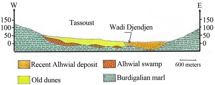
Figure 2. Geological section in the low zone of wadi Djendjen.
rigated. In this part, the water is not very deep (less the 6 meters) and its good permeability does not allow it to enjoy a sufficient natural protection to defend against surface pollution.
From upstream downstream, the characteristics of the water points selected for the study (Figure 4) are as follows:
• Point N1 corresponds to a drilling situated in a field of drinking water abstraction. Neither fertilized nor irrigated, its zone of influence coincides with a perimeter of protection of groundwater.
• Point N2 corresponds to a drilling located in an agricultural zone little or no fertilized, irrigated from aquifer little loaded with nitrates.
• Point N3 corresponds to a drilling situated in a zone of vegetable gardening and greenhouse regularly fertilized; this zone is irrigated from the aquifer.
• Point N4 corresponds to a drilling located in an agricultural zone fertilized and irrigated only for the summer period.
The other data used refer to groundwater piezometric fluctuations and meteorological data recorded at the coastal station of Achouat.
They relate to rainfall, temperature, relative humidity and evaporation.

Figure 3. Piezometric map in the plain of wadi Djendjen (May 2012).
4. Results and Discussions
The graph (Figure 5) that follows shows that the rainy season takes place in winter, between November and March. It is therefore natural that, on the piezometric level, the groundwater is in situation of “high water” between December and May, with a maximum in MarchApril.
On the scale of the year, the piezometric fluctuations vary from 2.5 m in point 1, which is the most downstream, with 3.5 m in point 4, upstream.
In terms of nitrate, water collected in points 1 and 2, located in zones not fertilized, sometimes with perimeters of protection, is characterized by low values (less than 27 mg/l), while those collected in points 3 and 4, which form part of zones of vegetable gardening fertileized and regularly irrigated, the concentrations are higher (60 to 120 mg/l). Aside from point 2 which is in an area irrigated with waters little loaded with nitrate (3 - 11 mg/l).
Figure 5 shows that the concentration of nitrates in the