Paper Menu >>
Journal Menu >>
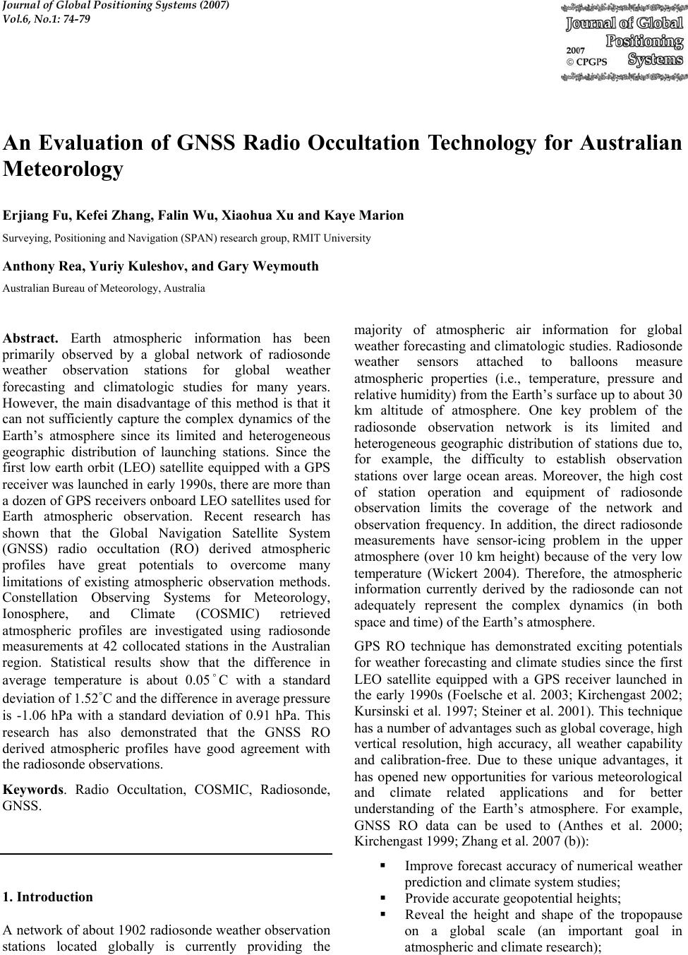 Journal of Global Positioning Systems (2007) Vol.6, No.1: 74-79 An Evaluation of GNSS Radio Occultation Technology for Australian Meteorology Erjiang Fu, Kefei Zhang, Falin Wu, Xiaohua Xu and Kaye Marion Surveying, Positioning and Navigation (SPAN) research group, RMIT University Anthony Rea, Yuriy Kuleshov, and Gary Weymouth Australian Bureau of Meteorology, Australia Abstract. Earth atmospheric information has been primarily observed by a global network of radiosonde weather observation stations for global weather forecasting and climatologic studies for many years. However, the main disadvantage of this method is that it can not sufficiently capture the complex dynamics of the Earth’s atmosphere since its limited and heterogeneous geographic distribution of launching stations. Since the first low earth orbit (LEO) satellite equipped with a GPS receiver was launched in early 1990s, there are more than a dozen of GPS receivers onboard LEO satellites used for Earth atmospheric observation. Recent research has shown that the Global Navigation Satellite System (GNSS) radio occultation (RO) derived atmospheric profiles have great potentials to overcome many limitations of existing atmospheric observation methods. Constellation Observing Systems for Meteorology, Ionosphere, and Climate (COSMIC) retrieved atmospheric profiles are investigated using radiosonde measurements at 42 collocated stations in the Australian region. Statistical results show that the difference in average temperature is about 0.05˚C with a standard deviation of 1.52˚C and the difference in average pressure is -1.06 hPa with a standard deviation of 0.91 hPa. This research has also demonstrated that the GNSS RO derived atmospheric profiles have good agreement with the radiosonde observations. Keywords. Radio Occultation, COSMIC, Radiosonde, GNSS. 1. Introduction A network of about 1902 radiosonde weather observation stations located globally is currently providing the majority of atmospheric air information for global weather forecasting and climatologic studies. Radiosonde weather sensors attached to balloons measure atmospheric properties (i.e., temperature, pressure and relative humidity) from the Earth’s surface up to about 30 km altitude of atmosphere. One key problem of the radiosonde observation network is its limited and heterogeneous geographic distribution of stations due to, for example, the difficulty to establish observation stations over large ocean areas. Moreover, the high cost of station operation and equipment of radiosonde observation limits the coverage of the network and observation frequency. In addition, the direct radiosonde measurements have sensor-icing problem in the upper atmosphere (over 10 km height) because of the very low temperature (Wickert 2004). Therefore, the atmospheric information currently derived by the radiosonde can not adequately represent the complex dynamics (in both space and time) of the Earth’s atmosphere. GPS RO technique has demonstrated exciting potentials for weather forecasting and climate studies since the first LEO satellite equipped with a GPS receiver launched in the early 1990s (Foelsche et al. 2003; Kirchengast 2002; Kursinski et al. 1997; Steiner et al. 2001). This technique has a number of advantages such as global coverage, high vertical resolution, high accuracy, all weather capability and calibration-free. Due to these unique advantages, it has opened new opportunities for various meteorological and climate related applications and for better understanding of the Earth’s atmosphere. For example, GNSS RO data can be used to (Anthes et al. 2000; Kirchengast 1999; Zhang et al. 2007 (b)): Improve forecast accuracy of numerical weather prediction and climate system studies; Provide accurate geopotential heights; Reveal the height and shape of the tropopause on a global scale (an important goal in atmospheric and climate research); 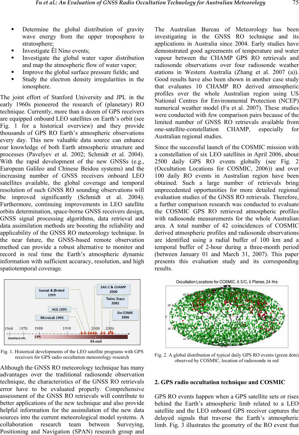 Fu et al.: An Evaluation of GNSS Radio Occultation Technology for Australian Meteorology 75 Determine the global distribution of gravity wave energy from the upper troposphere to stratosphere; Investigate Ĕl Nino events; Investigate the global water vapor distribution and map the atmospheric flow of water vapor; Improve the global surface pressure fields; and Study the electron density irregularities in the ionosphere. The joint effort of Stanford University and JPL in the early 1960s pioneered the research of (planetary) RO technique. Currently, more than a dozen of GPS receivers are equipped onboard LEO satellites on Earth’s orbit (see Fig. 1 for a historical overview) and they provide thousands of GPS RO Earth’s atmospheric observations every day. This new valuable data source can enhance our knowledge of both Earth atmospheric structure and processes (Pavelyev et al. 2002; Schmidt et al. 2004). With the rapid development of the new GNSSs (e.g., European Galileo and Chinese Beidou systems) and the increasing number of GNSS receivers onboard LEO satellites available, the global coverage and temporal resolution of such GNSS RO sounding observations will be improved significantly (Schmidt et al. 2004). Furthermore, continuing improvements in LEO satellite orbits determination, space-borne GNSS receivers design, GNSS signal processing algorithms, data retrieval and data assimilation methods are boosting the reliability and applicability of the GNSS RO meteorology technique. In the near future, the GNSS-based remote observation method can provide a robust alternative to monitor and record in real time the Earth’s atmospheric dynamic information with sufficient accuracy, resolution, and high spatiotemporal coverage. Fig. 1. Historical developments of the LEO satellite programs with GPS receivers for GPS radio occultation meteorology research Although the GNSS RO meteorology technique has many advantages over the traditional radiosonde observation technique, the characteristics of the GNSS RO retrievals error have to be evaluated properly. Comprehensive assessment of the GNSS RO retrievals will contribute to better applications of the new technique and also provide helpful information for the assimilation of the new data sources into the current meteorological model systems. A collaboration research team between Surveying, Positioning and Navigation (SPAN) research group and The Australian Bureau of Meteorology has been investigating in the GNSS RO technique and its applications in Australia since 2004. Early studies have demonstrated good agreements of temperature and water vapour between the CHAMP GPS RO retrievals and radiosonde observations over four radiosonde weather stations in Western Australia (Zhang et al. 2007 (a)). Good results have also been shown in another case study that evaluates 10 CHAMP RO derived atmospheric profiles over the whole Australian region using US National Centres for Environmental Protection (NCEP) numerical weather model (Fu et al. 2007). These studies were conducted with few comparison pairs because of the limited number of GNSS RO retrievals available from one-satellite-constellation CHAMP, especially for Australian regional studies. Since the successful launch of the COSMIC mission with a constellation of six LEO satellites in April 2006, about 2500 daily GPS RO events globally (see Fig. 2 (Occultation Locations for COSMIC, 2006)) and over 100 daily RO events in Australian region have been obtained. Such a large number of retrievals bring unprecedented opportunities for more detailed regional evaluation studies of the GNSS RO retrievals. Therefore, a further comparison research was conducted to evaluate the COSMIC GPS RO retrieved atmospheric profiles with radiosonde measurements for the whole Australian area. A total number of 42 coincidences of COSMIC derived atmospheric profiles and radiosonde observations are identified using a radial buffer of 100 km and a temporal buffer of 2-hour during a three-month period (between January 01 and March 31, 2007). This paper presents this evaluation study and its corresponding results. Fig. 2. A global distribution of typical daily GPS RO events (green dots) observed by COSMIC, location of radiosonde in red 2. GPS radio occ ul t at ion techni q ue a nd COSMI C GPS RO events happen when a GPS satellite sets or rises behind the Earth’s atmospheric limb related to a LEO satellite and the LEO onboard GPS receiver captures the delayed signals that traverse the Earth’s atmospheric limb. Fig. 3 illustrates the geometry of the RO event that 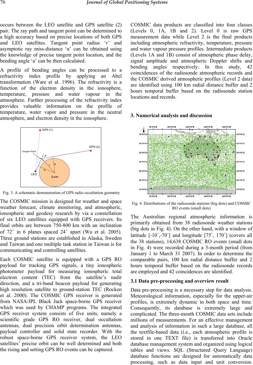 76 Journal of Global Positioning Systems occurs between the LEO satellite and GPS satellite (2) pair. The ray path and tangent point can be determined to a high accuracy based on precise locations of both GPS and LEO satellites. Tangent point radius ‘г’ and asymptotic ray miss-distance ‘α’ can be obtained using the knowledge of precise tangent point location, and the bending angle ‘а’ can be then calculated. A profile of bending angles can be processed to a refractivity index profile by applying an Abel transformation (Ware et al. 1996). The refractivity is a function of the electron density in the ionosphere, temperature, pressure and water vapour in the atmosphere. Further processing of the refractivity index provides valuable information on the profile of temperature, water vapor and pressure in the neutral atmosphere, and electron density in the ionosphere. LEO GPS (1) GPS (2) гα α а Earth Tangent Point Fig. 3. A schematic demonstration of GPS radio occultation geometry The COSMIC mission is designed for weather and space weather forecast, climate monitoring, and atmospheric, ionospheric and geodesy research by via a constellation of six LEO satellites equipped with GPS receivers. Its final orbits are between 750-800 km with an inclination of 72˚ in 6 planes spaced 24˚ apart (Wu et al. 2005). Three ground stations are established in Alaska, Sweden and Taiwan and one multiple task station in Taiwan is for communicating and controlling satellites. Each COSMIC satellite is equipped with a GPS RO payload for tracking GPS signals, a tiny ionospheric photometer payload for measuring ionospheric total electron content (TEC) from the satellite’s nadir direction, and a tri-band beacon payload for generating high resolution satellite to ground-station TEC (Rocken et al. 2000). The COSMIC GPS receiver is generated from NASA/JPL Black Jack space-borne GPS receiver which was used by CHAMP programs. The integrated GPS receiver system consists of five units, namely a scientific grade GPS RO receiver, dual occultation antennas, dual precision orbit determination antennas, payload controller and solid state recorder. With the robust space-borne GPS receiver system, the LEO satellites’ precise orbit can be well determined and both the rising and setting GPS RO events can be captured. COSMIC data products are classified into four classes (Levels 0, 1A, 1B and 2). Level 0 is raw GPS measurement data while Level 2 is the final products including atmospheric refractivity, temperature, pressure and water vapour pressure profiles. Intermediate products (Levels 1A and 1B) consist of atmospheric phase delay, signal amplitude and atmospheric Doppler shifts and bending angles respectively. In this study, 42 coincidences of the radiosonde atmospheric records and the COSMIC derived atmospheric profiles (Level 2 data) are identified using 100 km radial distance buffer and 2 hours temporal buffer based on the radiosonde station locations and records. 3. Numerical analysis an d discussion Fig. 4. Distributions of the radiosonde stations (big dots) and COSMIC RO events (small dots) The Australian regional atmospheric information is primarily obtained from 38 radiosonde weather stations (big dots in Fig. 4). On the other hand, with a window of latitude [-10˚,-70˚] and longitude [75˚, 170˚] (covers all the 38 stations), 14,638 COSMIC RO events (small dots in Fig. 4) were recorded during a 3-month period (from January 1 to March 31 2007). In order to determine the comparable pairs, 100 km radial distance buffer and 2 hours temporal buffer based on the radiosonde records are employed and 42 coincidences are identified. 3.1 Data pre -processing an d overview resu lt Data pre-processing is a necessary step for data analysis. Meteorological information, especially for the upper-air profiles, is extremely dynamic in both space and time. Consequently, its database is extremely large and complicated. The three-month COSMIC data sets include millions of measurements. For an effective management and analysis of information in such a large database, all the textfile-based data (i.e., each atmospheric profile is stored in one TEXT file) is transferred into Oracle database management system and organized using logical tables and views. SQL (Structured Query Language) database functions are designed for automatically data processing, such as data input and unit conversion. 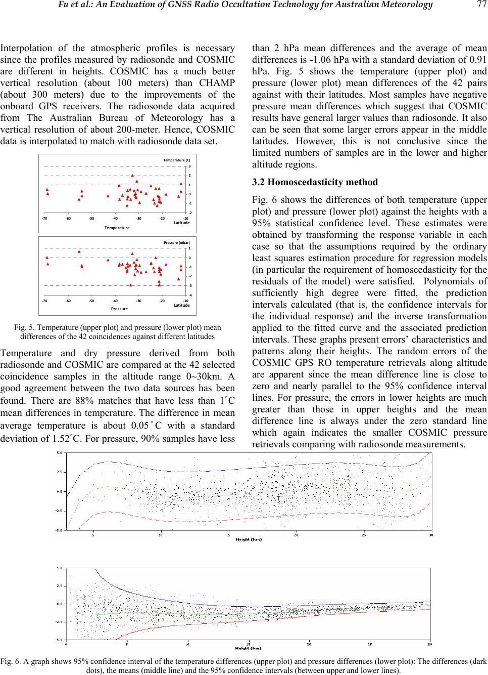 Fu et al.: An Evaluation of GNSS Radio Occultation Technology for Australian Meteorology 77 Interpolation of the atmospheric profiles is necessary since the profiles measured by radiosonde and COSMIC are different in heights. COSMIC has a much better vertical resolution (about 100 meters) than CHAMP (about 300 meters) due to the improvements of the onboard GPS receivers. The radiosonde data acquired from The Australian Bureau of Meteorology has a vertical resolution of about 200-meter. Hence, COSMIC data is interpolated to match with radiosonde data set. ‐2 ‐1 0 1 2 3 ‐70 ‐60 ‐50 ‐40 ‐30 ‐20 ‐10 Latitude Temperature(C) Tempe r at ur e ‐4 ‐3 ‐2 ‐1 0 1 ‐70 ‐60 ‐50 ‐40 ‐30 ‐20 ‐10 Latitude Pr essu r e (mbar) Pressure Fig. 5. Temperature (upper plot) and pressure (lower plot) mean differences of the 42 coincidences against different latitudes Temperature and dry pressure derived from both radiosonde and COSMIC are compared at the 42 selected coincidence samples in the altitude range 0~30km. A good agreement between the two data sources has been found. There are 88% matches that have less than 1˚C mean differences in temperature. The difference in mean average temperature is about 0.05˚C with a standard deviation of 1.52˚C. For pressure, 90% samples have less than 2 hPa mean differences and the average of mean differences is -1.06 hPa with a standard deviation of 0.91 hPa. Fig. 5 shows the temperature (upper plot) and pressure (lower plot) mean differences of the 42 pairs against with their latitudes. Most samples have negative pressure mean differences which suggest that COSMIC results have general larger values than radiosonde. It also can be seen that some larger errors appear in the middle latitudes. However, this is not conclusive since the limited numbers of samples are in the lower and higher altitude regions. 3.2 Homoscedasticity method Fig. 6 shows the differences of both temperature (upper plot) and pressure (lower plot) against the heights with a 95% statistical confidence level. These estimates were obtained by transforming the response variable in each case so that the assumptions required by the ordinary least squares estimation procedure for regression models (in particular the requirement of homoscedasticity for the residuals of the model) were satisfied. Polynomials of sufficiently high degree were fitted, the prediction intervals calculated (that is, the confidence intervals for the individual response) and the inverse transformation applied to the fitted curve and the associated prediction intervals. These graphs present errors’ characteristics and patterns along their heights. The random errors of the COSMIC GPS RO temperature retrievals along altitude are apparent since the mean difference line is close to zero and nearly parallel to the 95% confidence interval lines. For pressure, the errors in lower heights are much greater than those in upper heights and the mean difference line is always under the zero standard line which again indicates the smaller COSMIC pressure retrievals comparing with radiosonde measurements. Fig. 6. A graph shows 95% confidence interval of the temperature differences (upper plot) and pressure differences (lower plot): The differences (dark dots), the means (middle line) and the 95% confidence intervals (between upper and lower lines). 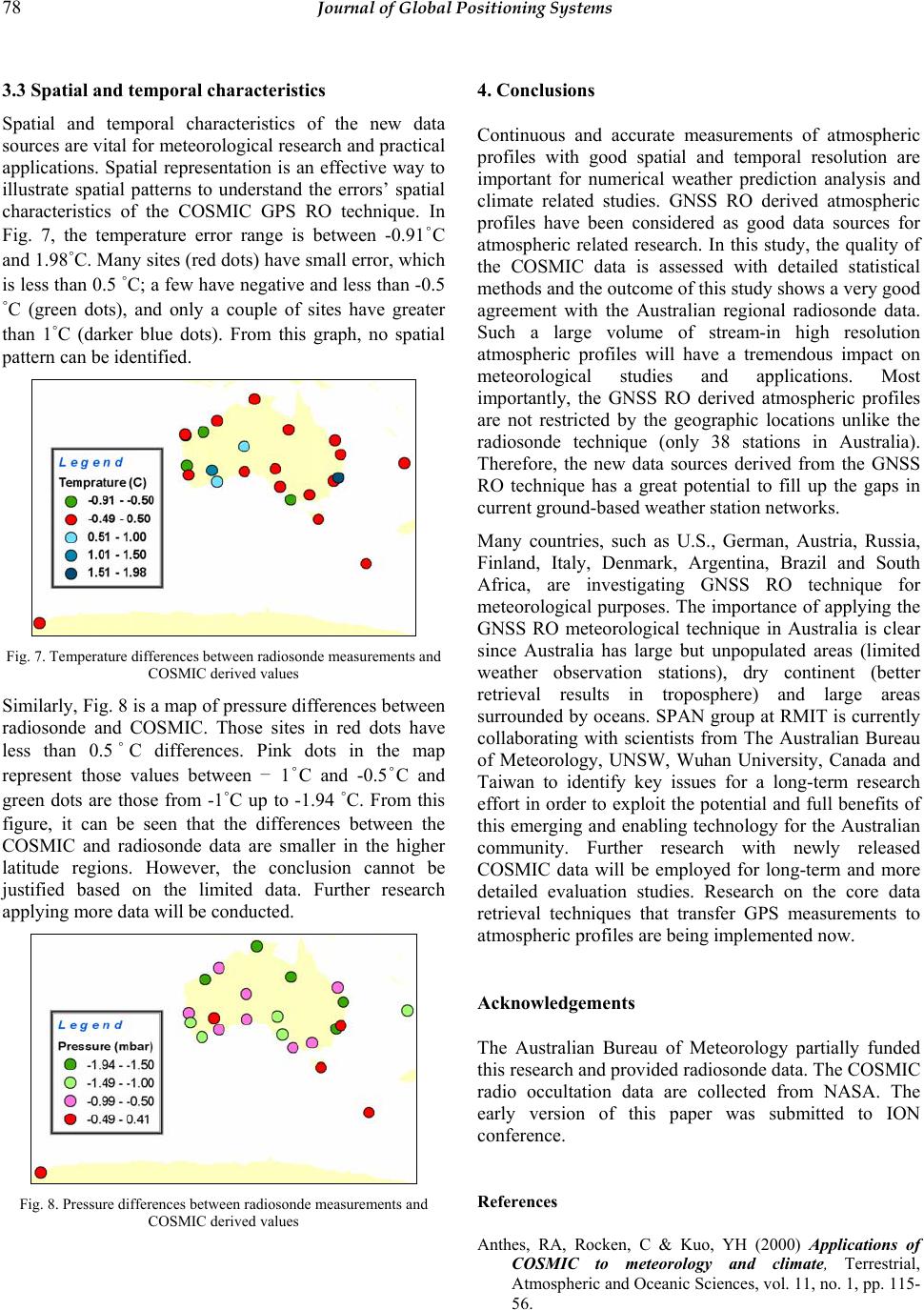 78 Journal of Global Positioning Systems 3.3 Spatial and temporal characteristics Spatial and temporal characteristics of the new data sources are vital for meteorological research and practical applications. Spatial representation is an effective way to illustrate spatial patterns to understand the errors’ spatial characteristics of the COSMIC GPS RO technique. In Fig. 7, the temperature error range is between -0.91˚C and 1.98˚C. Many sites (red dots) have small error, which is less than 0.5 ˚C; a few have negative and less than -0.5 ˚C (green dots), and only a couple of sites have greater than 1˚C (darker blue dots). From this graph, no spatial pattern can be identified. Fig. 7. Temperature differences between radiosonde measurements and COSMIC derived values Similarly, Fig. 8 is a map of pressure differences between radiosonde and COSMIC. Those sites in red dots have less than 0.5˚C differences. Pink dots in the map represent those values between – 1˚C and -0.5˚C and green dots are those from -1˚C up to -1.94 ˚C. From this figure, it can be seen that the differences between the COSMIC and radiosonde data are smaller in the higher latitude regions. However, the conclusion cannot be justified based on the limited data. Further research applying more data will be conducted. Fig. 8. Pressure differences between radiosonde measurements and COSMIC derived values 4. Conclusions Continuous and accurate measurements of atmospheric profiles with good spatial and temporal resolution are important for numerical weather prediction analysis and climate related studies. GNSS RO derived atmospheric profiles have been considered as good data sources for atmospheric related research. In this study, the quality of the COSMIC data is assessed with detailed statistical methods and the outcome of this study shows a very good agreement with the Australian regional radiosonde data. Such a large volume of stream-in high resolution atmospheric profiles will have a tremendous impact on meteorological studies and applications. Most importantly, the GNSS RO derived atmospheric profiles are not restricted by the geographic locations unlike the radiosonde technique (only 38 stations in Australia). Therefore, the new data sources derived from the GNSS RO technique has a great potential to fill up the gaps in current ground-based weather station networks. Many countries, such as U.S., German, Austria, Russia, Finland, Italy, Denmark, Argentina, Brazil and South Africa, are investigating GNSS RO technique for meteorological purposes. The importance of applying the GNSS RO meteorological technique in Australia is clear since Australia has large but unpopulated areas (limited weather observation stations), dry continent (better retrieval results in troposphere) and large areas surrounded by oceans. SPAN group at RMIT is currently collaborating with scientists from The Australian Bureau of Meteorology, UNSW, Wuhan University, Canada and Taiwan to identify key issues for a long-term research effort in order to exploit the potential and full benefits of this emerging and enabling technology for the Australian community. Further research with newly released COSMIC data will be employed for long-term and more detailed evaluation studies. Research on the core data retrieval techniques that transfer GPS measurements to atmospheric profiles are being implemented now. Acknowledgements The Australian Bureau of Meteorology partially funded this research and provided radiosonde data. The COSMIC radio occultation data are collected from NASA. The early version of this paper was submitted to ION conference. References Anthes, RA, Rocken, C & Kuo, YH (2000) Applications of COSMIC to meteorology and climate, Terrestrial, Atmospheric and Oceanic Sciences, vol. 11, no. 1, pp. 115- 56. 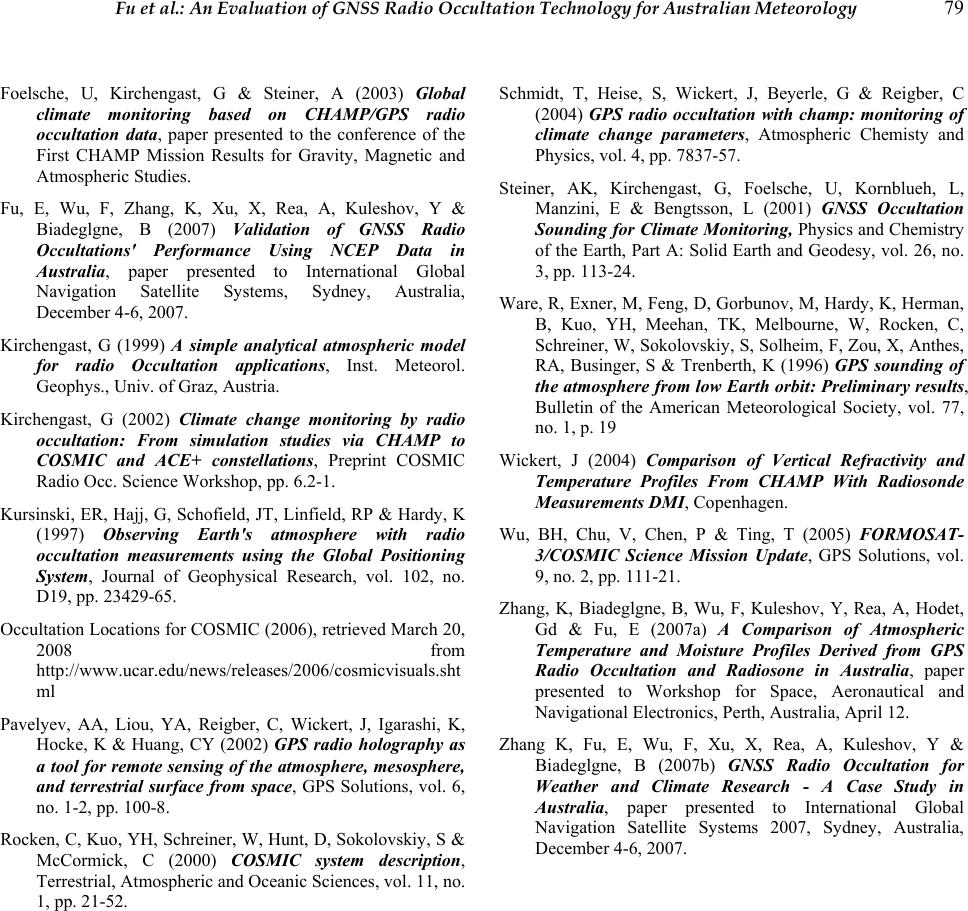 Fu et al.: An Evaluation of GNSS Radio Occultation Technology for Australian Meteorology 79 Foelsche, U, Kirchengast, G & Steiner, A (2003) Global climate monitoring based on CHAMP/GPS radio occultation data, paper presented to the conference of the First CHAMP Mission Results for Gravity, Magnetic and Atmospheric Studies. Fu, E, Wu, F, Zhang, K, Xu, X, Rea, A, Kuleshov, Y & Biadeglgne, B (2007) Validation of GNSS Radio Occultations' Performance Using NCEP Data in Australia, paper presented to International Global Navigation Satellite Systems, Sydney, Australia, December 4-6, 2007. Kirchengast, G (1999) A simple analytical atmospheric model for radio Occultation applications, Inst. Meteorol. Geophys., Univ. of Graz, Austria. Kirchengast, G (2002) Climate change monitoring by radio occultation: From simulation studies via CHAMP to COSMIC and ACE+ constellations, Preprint COSMIC Radio Occ. Science Workshop, pp. 6.2-1. Kursinski, ER, Hajj, G, Schofield, JT, Linfield, RP & Hardy, K (1997) Observing Earth's atmosphere with radio occultation measurements using the Global Positioning System, Journal of Geophysical Research, vol. 102, no. D19, pp. 23429-65. Occultation Locations for COSMIC (2006), retrieved March 20, 2008 from http://www.ucar.edu/news/releases/2006/cosmicvisuals.sht ml Pavelyev, AA, Liou, YA, Reigber, C, Wickert, J, Igarashi, K, Hocke, K & Huang, CY (2002) GPS radio holography as a tool for remote sensing of the atmosphere, mesosphere, and terrestrial surface from space, GPS Solutions, vol. 6, no. 1-2, pp. 100-8. Rocken, C, Kuo, YH, Schreiner, W, Hunt, D, Sokolovskiy, S & McCormick, C (2000) COSMIC system description, Terrestrial, Atmospheric and Oceanic Sciences, vol. 11, no. 1, pp. 21-52. Schmidt, T, Heise, S, Wickert, J, Beyerle, G & Reigber, C (2004) GPS radio occultation with champ: monitoring of climate change parameters, Atmospheric Chemisty and Physics, vol. 4, pp. 7837-57. Steiner, AK, Kirchengast, G, Foelsche, U, Kornblueh, L, Manzini, E & Bengtsson, L (2001) GNSS Occultation Sounding for Climate Monitoring, Physics and Chemistry of the Earth, Part A: Solid Earth and Geodesy, vol. 26, no. 3, pp. 113-24. Ware, R, Exner, M, Feng, D, Gorbunov, M, Hardy, K, Herman, B, Kuo, YH, Meehan, TK, Melbourne, W, Rocken, C, Schreiner, W, Sokolovskiy, S, Solheim, F, Zou, X, Anthes, RA, Businger, S & Trenberth, K (1996) GPS sounding of the atmosphere from low Earth orbit: Preliminary results, Bulletin of the American Meteorological Society, vol. 77, no. 1, p. 19 Wickert, J (2004) Comparison of Vertical Refractivity and Temperature Profiles From CHAMP With Radiosonde Measurements DMI, Copenhagen. Wu, BH, Chu, V, Chen, P & Ting, T (2005) FORMOSAT- 3/COSMIC Science Mission Update, GPS Solutions, vol. 9, no. 2, pp. 111-21. Zhang, K, Biadeglgne, B, Wu, F, Kuleshov, Y, Rea, A, Hodet, Gd & Fu, E (2007a) A Comparison of Atmospheric Temperature and Moisture Profiles Derived from GPS Radio Occultation and Radiosone in Australia, paper presented to Workshop for Space, Aeronautical and Navigational Electronics, Perth, Australia, April 12. Zhang K, Fu, E, Wu, F, Xu, X, Rea, A, Kuleshov, Y & Biadeglgne, B (2007b) GNSS Radio Occultation for Weather and Climate Research - A Case Study in Australia, paper presented to International Global Navigation Satellite Systems 2007, Sydney, Australia, December 4-6, 2007. |