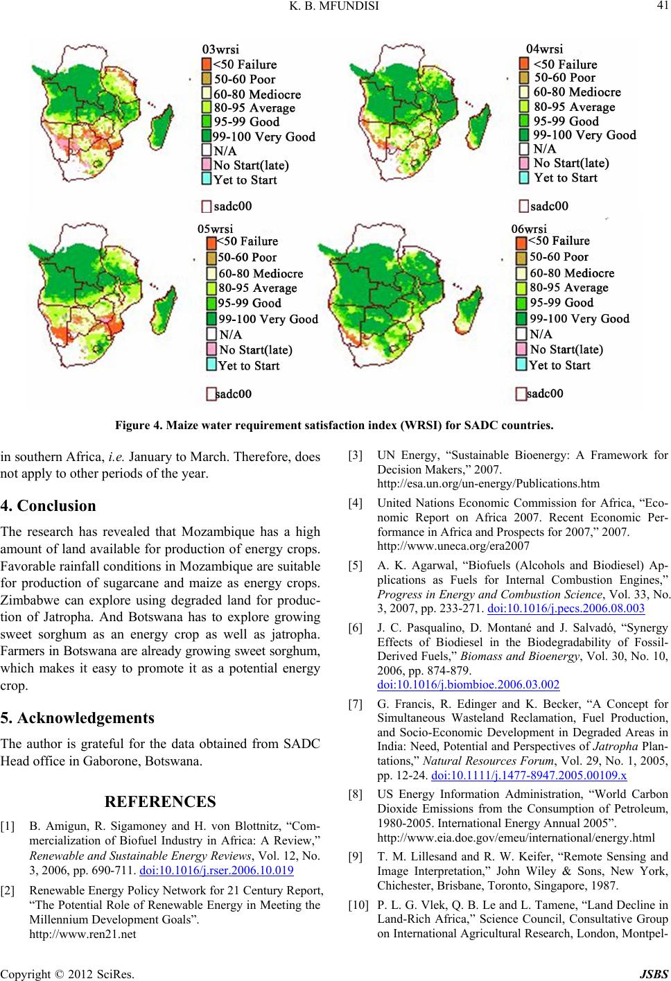
K. B. MFUNDISI
38
diesel from Jatropha have started in South Africa, Ma-
lawi, Lesotho, Swaziland and Zambia. Other countries in
the region are also at a planning stage to embark on bio-
energy production projects. However, large scale produc-
tion of energy crops requires land and water resources.
Setting aside land and water resources for production of
energy crops is a challenge for developing countries that
are also struggling to meet their food security needs
and maintain ecosystems productivity. Even developing
countries that have relatively high GDPs like Botswana
depend on imports to meet their food security needs, and
the remaining ecosystems service a lucrative wildlife
based tourism industry. The two main challenges faced
by these countries are: how to set aside land for produc-
tion of energy crops without infringing into land avail-
able for food production and conservation of natural re-
sources, and how to ensure that there is adequate source
of water required for production of energy crops as well
as that needed to sustain ecosystem productivity.
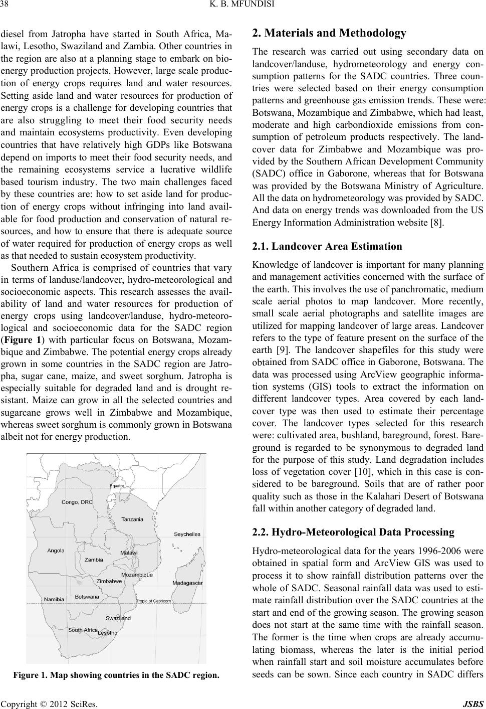
Southern Africa is comprised of countries that vary
in terms of landuse/landcover, hydro-meteorological and
socioeconomic aspects. This research assesses the avail-
ability of land and water resources for production of
energy crops using landcover/landuse, hydro-meteoro-
logical and socioeconomic data for the SADC region
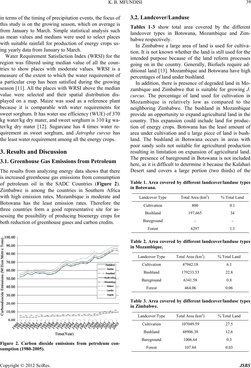
(Figure 1) with particular focus on Botswana, Mozam-
bique and Zimbabwe. The potential energy crops already
grown in some countries in the SADC region are Jatro-
pha, sugar cane, maize, and sweet sorghum. Jatropha is
especially suitable for degraded land and is drought re-
sistant. Maize can grow in all the selected countries and
sugarcane grows well in Zimbabwe and Mozambique,
whereas sweet sorghum is commonly grown in Botswana
albeit not for energy production.
Figure 1. Map showing countries in the SADC region.
2. Materials and Methodology
The research was carried out using secondary data on
landcover/landuse, hydrometeorology and energy con-
sumption patterns for the SADC countries. Three coun-
tries were selected based on their energy consumption
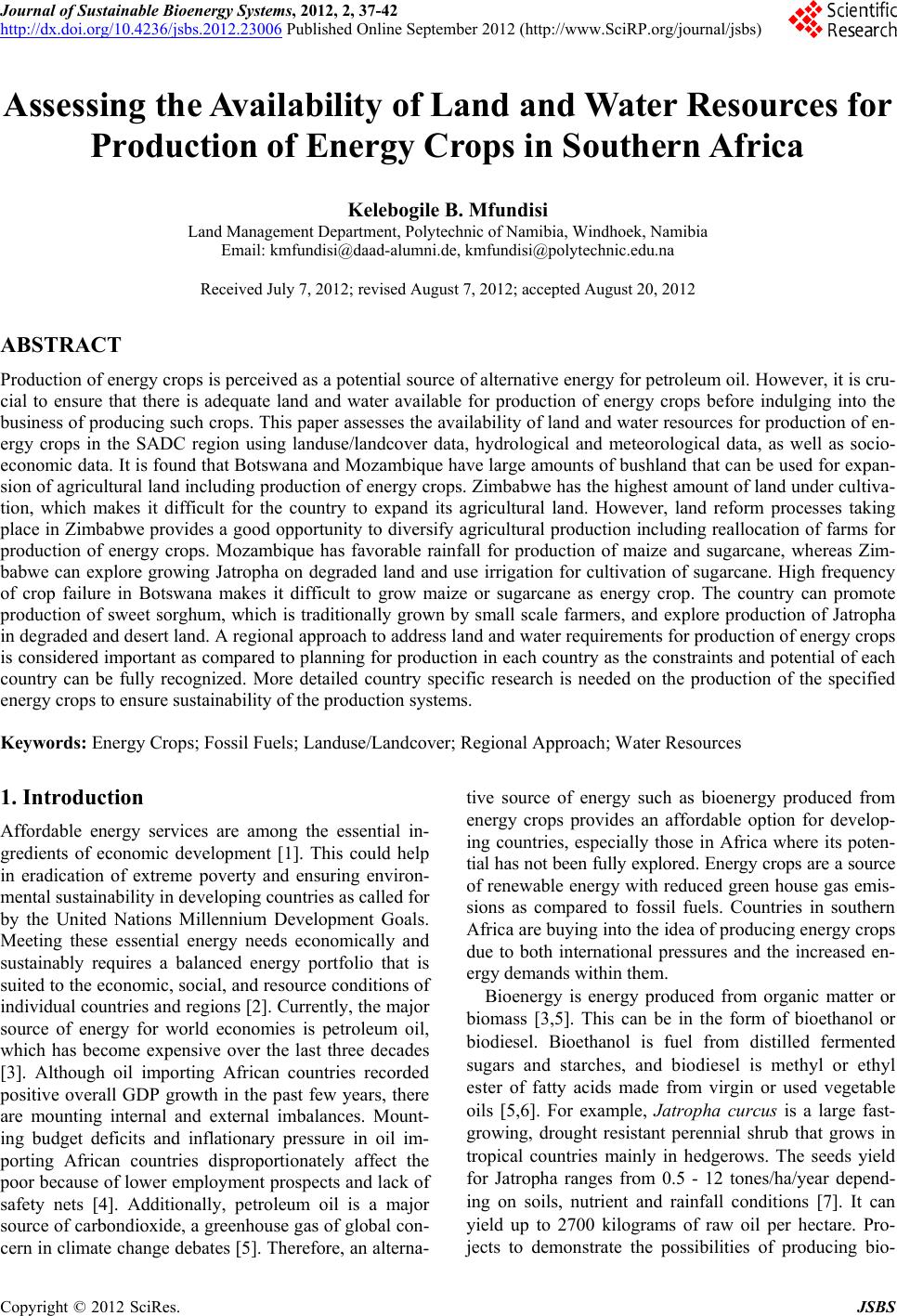
patterns and greenhouse gas emission trends. These were:
Botswana, Mozambique and Zimbabwe, which had least,
moderate and high carbondioxide emissions from con-
sumption of petroleum products respectively. The land-
cover data for Zimbabwe and Mozambique was pro-
vid ed by the Southern African Development Community
(SADC) office in Gaborone, whereas that for Botswana
was provided by the Botswana Ministry of Agriculture.
All the data on hydrometeorol ogy was provided by SADC.
And data on energy trends was downloaded from the US
Energy Inform at i on Administrat i on websi t e [8].
2.1. Landcover Area Estimation
Knowledge of landcover is important for many planning
and management activities concerned with the surface of
the earth. This involves the use of panchromatic, medium
scale aerial photos to map landcover. More recently,
small scale aerial photographs and satellite images are
utilized for mapping land cover of large areas. Landcover
refers to the type of feature present on the surface of the
earth [9]. The landcover shapefiles for this study were
obtained from SADC office in Gaborone, Botswana. The
data was processed using ArcView geographic informa-
tion systems (GIS) tools to extract the information on
different landcover types. Area covered by each land-
cover type was then used to estimate their percentage
cover. The landcover types selected for this research
were: cultivated area, bush land, b areground, forest. Bare-
ground is regarded to be synonymous to degraded land
for the purpose of this study. Land degradation includes
loss of vegetation cover [10], which in this case is con-
sidered to be bareground. Soils that are of rather poor
quality such as those in the Kalahari Desert of Botswana
fall within another category of degraded land.
2.2. Hydro-Meteorological Data Processing
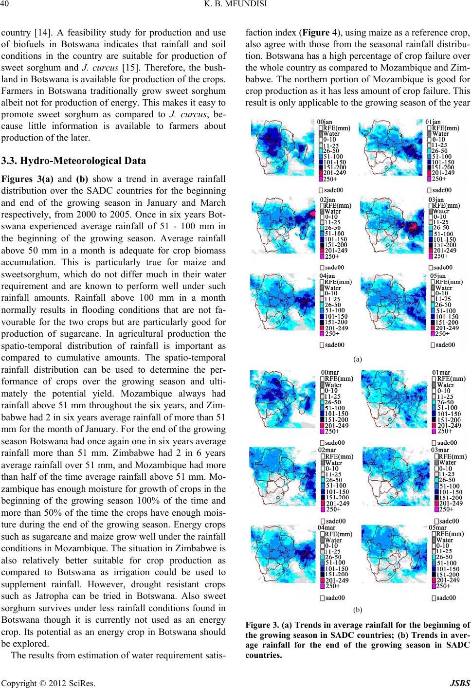
Hydro-meteoro logical data for the years 199 6-2006 were
obtained in spatial form and ArcView GIS was used to
process it to show rainfall distribution patterns over the
whole of SADC. Seasonal rainfall data was used to esti-
mate rainfall distribution over the SADC countries at the
start and end of th e growing season. The growing season
does not start at the same time with the rainfall season.
The former is the time when crops are already accumu-
lating biomass, whereas the later is the initial period
when rainfall start and soil moisture accumulates before
seeds can be sown. Since each country in SADC differs
Copyright © 2012 SciRes. JSBS