
1. Introduction
The zoning as tool for cities’ development rises in terms of use in the last decades to shape from small tissues to the largest muscles of the city to achieve various goals. In fact, zoning control developments in the city or specific area that might slow down or stimulate developments or use https://oleariatownplanning.com/zoning-in-town-planning/.
It’s about 100 years from Euclid’s case that Supreme Court legitimized zoning regulations which continued to progress from the 1920s in the United States. In recent years, prevalent zoning codes such as Euclidean, Form-based, Performance and etc. didn’t meet the necessities of urban areas due to incomprehensive and restrictive (Lauren M. Gowdy, 2009) [2]. Therefore, planners, designers and developers seek to regulate, design and introduce a comprehensive zoning code that promotes mix-use, better urban design and future developments. Different countries try to prepare development plans strategically based on zoning, and most cities by applying and updating zoning plan propel sustainable development.
From 1962 (Kabul’s First Master Plan Approved) to 2002 (Horizon year of Kabul’s third Master Plan) the three master plans were based on land use plan. In 2011, JICA Master Plan for Kabul introduced zoning plan beside land use as a tool to regulate the individual land use activities (JICA, 2011) [3]. But, till 2020 any practical step to regulate zoning plan not take in hand. Finally, the “Regulation of Issuing Building Permit and Preventing Illegal Construction” in 2021 passed which plays as a regulation for zoning (Kabul Municipality 2021) [4]. Following, the “Procedure of Issuing Building Permit for Planned and Unplanned areas” passed which is a written format of issuing building permits as a zoning regulation, also, details of different zones and their criteria are illustrated in this document (Kabul Municipality 2021) [5]. Unfortunately, any regulation with specific objectives of applying zoning plan and considering specific zoning code for Kabul City has not been considered yet. Moreover, a zoning regulation which consists of two parts: a written document and map(s) didn’t introduce them together.
The government of Afghanistan is a poor country economically and technically, before defeating Islamic Republic of Afghanistan several countries especially Japan technically assisted Afghanistan’s urban sectors through Japan International Cooperation Agency (JICA). Due to not recognition Taliban government by United Nations, the Kabul Municipality technical team is not able to tackle the issue technically and experimentally (Author).
Therefore, the main purpose of this research is to draw a path for urban sectors to distinguish the differences between zoning codes currently applied in developing cities with positive results as per Kabul City context, existing trend of land use and developments.
1.1. Zoning History
“It is He who created the night and the day, the sun and the moon, each swimming in an orbit” Quran, Chapter 17, Verse 21, Anbia. Basically the universe, Solar System, Earth and all other systems created and developed by God segregated and distinguish accordingly for better use. On the other hand, when we have been growing up, our parents taught us to keep everything in their proper place, otherwise, we will lose the orientation and mismatched might create problems. Substantially, land use planning and zoning planning have similar roots of better use of land in different scales of a city.
Zoning ordinance and land use planning are cities’ primary tools to provide better access for high-quality services and density management (Mona Qureshi and Robin King 2015) [6]. Before applying different zoning codes, land use planning was a key for land ordering and disposition of facilities, land, resources and services. https://www.planetizen.com/definition/land-use and, cities built-up regulated through judiciary decisions while conflicts arise between neighbors to using their property (Amanda Erickson, 2012) [7]. The zoning ordinance had passed several steps until sophistication, first step over land use restrictions established in Los Angeles at 1904. Subsequently, New York adopted the first zoning regulations in a city-scale at 1916. Finally, the first ever constitutionality of zoning prepared based on case Village of Euclid in 1926 by Supreme Court.
With or without any doubt zoning had racial segregation and functioned as a gentrification process in low class communities. Injustice occurred during zoning planning, while some owners achieved desirable added land value and the others not. Common cases of racial segregation back to the nineteenth century in USA against black families. Moreover, many legal cases in this regard were referred to the judicial authorities of the time such as case Buchnan and Warley in 1917 (Chair Cecilia Rouse, Jared Bernstein, Helen Knudsen and Jeffery Zhang, Exclusionary Zoning, 2021) [8]. Meanwhile several other cases of changing zoning areas from one use to another use or placing park and playgrounds in hope to displace black families (Richard Rothstein, 2014) [9].
1.2. Zoning Definition
Zoning is a set of laws that restrict and define the type of land uses and development that can occur on each parcel of land in a community. Zoning typically divides a community into districts that group compatible uses together and exclude incompatible uses.
Zoning laws typically specify the areas in which residential, industrial, recreational or commercial activities may take place. They also provide regulations that determine building placement (setbacks), height of structures, lot sizes, lot coverage, parking and other requirements. https://planning.clevelandohio.gov/zoning/index.php
1.3. Zoning Code
Zoning code is a local power over land use control which decides how building(s) can be built where. https://www.planetizen.com/definition/zoning-codes
1.4. Zoning Ordinance/Regulation
Zoning ordinance is a process of dividing region or land into zones or districts and specifying the allowed or prohibited land uses in residential, commercial, agricultural and industrial (Will Kenton 2022) [10].
2. Zoning Types
After performing first zoning code in Euclid, different zoning codes introduced in other states and countries based on the physical and socio-economic situation of their cities. For better understanding of applied zoning codes, brief information gathered here to explore and discern the better applicable code into Kabul city. Different zoning codes across the world based on countries’ experience, introduced, applied and flourished. Different zoning codes prevalent while some of them are same in basics but differ in names with each other, though, the above-mentioned codes as per countries context shortly introduced.
2.1. Euclidean Zoning
Euclidean zoning name got from Euclid City where implemented for the first time, separates the zones into distinct areas rather than mix-use implementation. Generally this type of zoning poses many issues especially on class segregation, climate change and energy (Tamar Gharibian, 2020) [11]. Euclidean zoning focus on segregation of community-based on uses; often specify minimum and maximum requirements of FAR, BCR, setbacks and height of building and discourage mix use and development (Benjamin Schneider, 2019) [12].
2.2. Form-Based Zoning
As a development regulation addresses the physical characteristics and relationship between buildings and public realm https://formbasedcodes.org/definition/. This form of zoning was introduced as an alternative to Euclidean zoning codes that focus on the form of buildings https://www.planetizen.com/definition/form-based-codes. This form of zoning creates urban identity based on unique characteristics and context surrounding areas (Qurnfulah, E. and Isah, A. 2019) [13]. French cities use form-based codes in their planning system (JLL Staff Reporter, 2019) [14]
The president of Form-Based Code Institute, Peter Katz defines FBC as a “method of regulating development to achieve a specific urban form [by creating] a predictable public realm primarily by controlling physical form, with a lesser focus on land use” (Lauren M. Gowdy, 2009) [2]. Form-based code focuses on design elements such as building size and placement, style and walkability rather than land use, which encourages mix uses and walkable communities (Benjamin Schneider, 2019) [12]. Therefore, pure Form-based code is easier to implement in a clean slate or growing community with development trend (Arista Strungys, 2008) [15].
2.3. Functional Zoning
In this form of zoning land use define according to their function like residential, commercial, or industrial https://transportgeography.org/contents/chapter8/urban-land-use-transportation/land-use-zoning/ and physical characteristics like development density, area’s dominant activities, buildings and lot characteristics (Rashid Faridi, 2021) [16]. The example of applied functional zoning is based on area’s dominant activity implemented in Wenzhou Marine, China (Ma R., Chen, J., Pan Q., Cheng Y.; Wang W., Zhu B., Ma J. & Li J., 2022) [17].
2.4. Intensity Zoning
In this zoning, code land uses are defined by the permitted intensity level of the allowed commercial and residential unit of surface. Density is a criterion used to avoid wasteful usage of real estate. https://transportgeography.org/contents/chapter8/urban-land-use-transportation/land-use-zoning/. The intensity zoning areas have more flexibility, where developers can decide type of structure to build on the property. https://millmanland.com/knowledge/what-are-the-different-types-of-land-zoning/#:~:text=Intensity,based%20on%20the%20surface%20area.
2.5. Incentive Zoning
Incentive zoning was first implemented in Chicago based on rewards to meet urban development goals by encouraging developers. https://en-academic.com/dic.nsf/enwiki/35779, and requires sufficient land value to afford additional costs (Benjamin Schneider, 2019) [12], meanwhile, incentive zoning is used for revitalization purposes. https://millmanland.com/knowledge/what-are-the-different-types-of-land-zoning/
2.6. Negotiated Zoning
Negotiated zoning is also called bargaining zoning. This zoning code evolved out of the Euclidean zoning code that allows landowners from rigidity to flexibility in the negotiation process (City of Austin, Code 101) [18]. Developers bargain over permission to build between the rigidity of zoning ordinances and free-market flexibility (Erin Ryan 2002) [19].
2.7. Performance Zoning
This is a flexible zoning code, that permits variety of land uses according to concern and need of local community (Dalit Shach-Pinsly & Isaac GuediCpeluto, 2020) [20]; sometimes called flexible zoning or impact zoning related to factors that impacts on site’s development and its impact on neighborhood. Natural features mapped, identified and protected from development https://www.chescoplanning.org/MuniCorner/eTools/61-PerformanceZoning.cfm#:~:text=Performance%20zoning%2C%20sometimes%20called%20%22impact,the%20development%20on%20its%20neighborhood. The key elements of performance zoning include vehicle trips, noise or density level and consider during planning process and implementation (City of Austin, Code 101) [18].
2.8. Hybrid Zoning
This is a combination of Form-Based Codes and traditional zoning controls. (Arista Strungys, 2008) [15], or, this is a zoning regulation that combines different aspects of zoning models (City of Austin, Code 101) [18], but, Hybrid codes missing the public realm concept versus form-based codes (Kaizer Rangwala 2009) [21].
3. The Relationship of Different Zones in Zoning Plans
Generally zoning categories are divided into three to four zones residential, commercial, industrial and agriculture (M. Ghorbanian 2020) [22]. Zoning is used to prevent interfering activities that harm public health and preserve the character of communities. Each zone’s performance in a city is based on its characteristics and functions. The operations in each zone must fulfill other zone needs with the lowest socio-economic and environmental impact (Figure 1).
The zones location in the urban vicinity defines based on the following factors and characteristics:
a) Existing land use.
b) Forecasted development potentials.
c) The side(s) of city development.
d) Socio-economic fabric.
e) Potentially areas for investments.
f) The resources and flow side of surface water.
g) Wind direction.
The Kabul informal settlements’ zoning ordinance is based on three categories of Mix-use, residential and industrial (Kabul Municipality 2021) [5]. The planners in Kabul Municipality focused on mixed-use zone, based on existing land use. The existing demand of residents prioritized and tried to supersede and promotes the daily-based necessity by walkability and cycling instead of fossil-based transportation. In every type of zoning, planners tried to distinguish each zone by specific permitted and prohibited uses (Author). The mix land use along all corridors and spines is uncommon, different land uses to create different
![]()
Figure 1. Zones relationship of classified zones and Family Class.
problems. Social inequalities of construction right, pseud role of commercial activity to the areas where the development’s potential not exist or forecasted, traffic and noise pollution will be the negative results of such zoning planning (M. Ghorbanian 2020) [22] (Figure 2).
4. Zoning Purposes
The purpose of zoning is to regulate, control land and property market, and stimulate or slow down development in specific areas. https://urban-regeneration.worldbank.org/node/39#:~:text=The%20purpose%20of%20zoning%20is,down%20development%20in%20specific%20areas. According to experts and applied zoning regulation the following purposes describe as bellow:
a) The primary purpose of zoning is to promote local authorities that how a city develops (Curtis Jackson, 2022) [23].
b) Develops the property by preserving the local environment and property value under the local government’s jurisdiction. (Matthew Paxton)
c) It helps towns and cities plan and organize them by the best use of land and possible permission (Matthew Carter, 2022) [23].
d) It promotes property values and stability to the benefits of entire community by segregation of conflicting land uses, protecting safety and public health and orderly developments (Rinal Patel, 2022) [23].
e) Encourage appropriate land use, safety protection and preservation of affordable housing (Michael Chandler & Gregory Dale 2001) [24].
f) It reduces or controls the traffic congestion, population density in relation to available facilities.
g) It creates a harmonious, attractive and convenient community.
h) Encourage desirable development activities, preservation of forest land, heritage sites, natural environment and agriculture land.
5. Role of Land Mafia in Zoning and Other Planning Systems
After industrial revolution, while the cities become the hub of product, trade, job
and education, cities’ growth foster by rich people. Gradually, migration from rural areas toward cities speed-up and development started around industrial areas. Land value increase day by day, governmental mafias align with real estate developer to control planning system where they could be able to enforce their benefits (Author).
Palermo the capital city of Sicily during dominant era of Mafia’s group between the 1950s and the 1960s faced with their activities such as illegal construction, destroying urban environment, extorting money from shopkeepers, destroying architectural landscape and other related issues that affected society direct and indirect. Above mentioned factors foster mafias to sack cities and create injustice (Architexturez.net, 2020) [25].
Zoning plan in megacities as a development tool controlled by the real estate mafia’s under organized crime; their role is inevitable with inappropriate direction of the city from design to implementation to obtain their benefits. The city of Mumbai in India is a good example of illegal development after the 1990s economic boom while Mumbai’s land development policies draw by mafia (Liza Weinstein 2008) [26], Transferable Development Right (TDR) in Mumbai and other cities introduced as a technique of development, (NITI Aayog 2020) [27], whereas, developers use such technique for their own benefits that result in the corruption and imbalance city development. In 1981 according to zoning plan the Caribbean Tower apartment had the right to build additional eighty units, this complex sold to an entity called Firewater, N.V. Firewater transferred the right to Florida East Coast Property, the owner of Flamingo Property. The Courts of Appeal in Florida found that TDR from Caribbean Tower to Firewater impaired Gordon’s collateral. In the 1990s, the trial court impose an equitable lien on surreptitiously transferred right of Flamingo property (Joseph D. Stinson, 1996) [28].
Similar to the case of Mumbai, Kabul experienced an economic boom after 2001 by defeat of Taliban Regime. Illegal construction started around the city including planned and unplanned area (Photo 1). Mafia’s tampered and acquired lands and paid bribe during construction which has been contrary with the neighborhood and maximum use of FAR and BCR. Illegal activities never controlled due to involvement of high-rank officials. The rent and price of property rose similar to the developed countries. Vice-versa of countries like USA neither courts nor did responsible authorities come to tackle the issue. All these issues change the city aspects and now zoning ordinance will not perform accordingly due to mismatching built-ups in every plot.
6. Current Situation of Zoning Planning in Kabul
The first master plan for Kabul city prepared by Afghanistan and Russian experts between 1962-64 covered 237.8 km2 to the planned population of 0.8 Million. Many Detail plans and structure plans were prepared to perform as urban design and land use planning (JICA, 2011) [3]. This process of detail plans implementation confront with problems like time consuming to prepare detail plans, lack of sufficient technical team to prepare plans as per city widening and land acquisition in built area (Author).
City growth and expansion become much faster after 2001, the situation continued for 10 years till the Japan International Cooperation Agency (JICA) in response to request from Government of Afghanistan revised the Kabul City
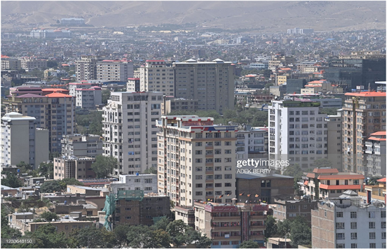
Photo 1. Kabul Illegal Built-up in Residential Area (Getty Images, Adek Berry, 2021).
Master Plan in 2011. Zoning plan as a type of land use plan introduced in JICA master plan as a lower level after master plan (JICA, 2011) [3]. In this regard several trainings held inside and outside of Afghanistan by JICA experts to introduce zoning planning for Kabul Municipality engineers. In 2019 Kabul Urban Development Framework (KUDF) established a vision for Kabul growth and stated that “subsequent plans and design proposals will further develop the ideas and strategies”. In this framework to develop an area, zoning plan introduced to achieve better and sustainable development beside urban design (Sasaki, 2019) [1].
Issuing building permit had been based on previous master plan and detailed plan and landowner obligated to consider BCR and number of floors. After execution of KUDF, issuing building permit faced with many problems. The KUDF as a guideline did not specify FAR, BCR, Setbacks and maximum heights, only the land uses and height limits pointed which was in controversy of issuing building permit as per previous master plan.
Finally, Kabul Municipality prepared the “Regulations for issuing building permits and preventing construction violations” issued in 2021 that play the role of zoning ordinance (Kabul Municipality 2021) [4]. At the end of 2021 based on this regulation, the “Procedure of Issuing Building Permit to the Planned and Unplanned Area” was enacted (Kabul Municipality 2021) [4]. The City of Kabul has 22 Districts, whereas the zoning plans for planned areas of Districts 3, 4, 5, 6, 10, 11, 12, 15 and 16 have been prepared by City Planning and Implementation Directorate and approved. Currently building permit issues are based on approved zoning plans and rest of districts are under work. Similarly, the Land Readjustment and Urban Redevelopment Directorate carry out the responsibility of developments in unplanned areas and prepared zoning plans of Districts 4, 7, 10 and 17. Unfortunately, none of them yet been approved, until the proposed road network of Kabul for unplanned areas gets the approval. The purpose of zoning plans in unplanned area is not only land use planning, but road network expansion and providing public facilities.
Prepared zoning plans for Kabul City are similar to land use plans in KUDF and don’t follow any specific zoning code (Figure 3 and Figure 4).
7. Impacts of Construction Violation on Kabul Zoning Plans
After formulation of third master plan in 1978, rapid urban growth and the need for shelter caused informal settlements growth which does not conform to third master plan (Sasaki, 2019) [29]. A long time gap between Third Master Plan and JICA Master Plan surrender Kabul City in vacuum situation of planning control and Implementation. Organic development and illegal construction confuse the government and planners to tackle indirection.
Zoning plan as an alternative for the development of unplanned areas will face some major issues, briefly pointing here.
1) The constructed buildings in unplanned areas where the local roads and alleys’ widths are less than 6 meters have similarities in terms of materials and
![]()
Figure 3. Kabul future land use plan (Sasaki, 2019) [1].
type, even plentiful luxury houses and buildings exist. The relevant regulations don’t clarify how to deal with the buildings come inroad and alleys development. The Kabul Municipality is not able to pay land and buildings acquisition, while most of the roads and alleys widening consider two sides.
2) The major changes of road network between JICA Master Plan and KUDF, while the JICA Master Plan focused on a grid and proper road network whereas the KUDF considers the existing situation of road network to prevent major destruction and economic loss. Most of the landowners constructed their buildings based on JICA Master Plan’s road network and they are not blameful of such major changes.
3) Landownership clarification and land’s lawsuit is another problem in unplanned area. Without any proper process of land clarification or related law enforcement the process of landowners’ agreement or acquisition is not easy.
4) The KUDF proposed to apply urban design for corridors. Two chapters out of six belong to corridor urban design (Dar ul-Aman Corridor District and Massoud Corridor District). All urban design criteria defined nodes development and strategies of implementation (Sasaki, 2019) [30] and (Sasaki, 2019) [31]. Most of corridors’ sides consist of organic development, where the shapes of plots are irregular and some of them can’t comply the building permit requirement (Kabul Municipality 2021) [5]. Therefore, issuing building permit as per the existing situation will not give us the ideal result.
5) Organic growth and land use change from agriculture to residential in different part of Kabul city resulted in the creation of deadlocks. The widening and opening deadlocks may result in destruction of houses fully and partially, whereas the rate of destruction might be more than forecasts, whereas the Kabul Municipality is not responsible for acquisition payment. The requirements for
![]()
Figure 4. District 4 development zoning plan for planned and unplanned area (Kabul Municipality).
issuing building’s permit for plots located alongside deadlocks are the followings:
a) The minimum width of deadlocks up to 50 meters must not be less than 6 meters.
b) In case of maximum of three plots, with a maximum of 50 meters of deadlocks, can be considered the width of deadlocks up to 4 meters.
c) In deadlocks with 6 meters in width and less than 50 meters in length, the car’s turning area is not necessary.
d) The deadlocks with more than 150 meters in length should be open, based on observation of the technical and field team. (Kabul Municipality 2021) [5].
8. Criticism
Every process of urban development including zoning plans must be evaluated from different perspectives such as social, economic, aesthetic and ecological. Zoning ordinance as a tool of regulating building construction as per specified land use play a major role in controlling population, urban development, investment absorbing, racial segregation, densification and etc. Therefore, jobbery feels every time and everywhere by developers, communities and individuals. (Author)
Developers always try to invest their money where they know in advance to purchase land and get the targeted benefit of development. Revising zoning plans in planned areas after a period of time keeps the developers lobby to maximize their profit (Dr. Andreas Schulze Bäing and Dr. Brian Webb, 2020) [32]. Zoning has its own social and structural deficiency, if there are only administrative and commercial uses in some area, it will be empty of human activity at night, also, traffic congestion during day and night will experience its peak and bottom condition in a city, while diversity and mixing uses will cause people to move in the city at all hours of day and night. Meanwhile, not considering the existing demand and supply for activities will create access and commute problem in a city.
Traditional zoning with rigidity of uses in each zone that separates residential uses from commercial and administrative zones where shops, work and other daily activities are dependent on cars. Therefore, travel between zones has a direct impact on socio-economic and environment of the city (Will Kenton 2022) [10]. There is one thing which should not be forgotten, zoning codes have their own positive and negative points. If the experts are not thorough in every aspect of a city to select a comprehensive zoning code, the optimal result will not be achieved (Jim Fedako, 2006) [33].
Rigidity and flexibility of zoning is the most important point. Revising code after a period of time parallel with development potential is a need; therefore, a flexible and vibrant zoning ordinance will prevent major changes and waste of wealth in construction sector.
9. Conclusions
Informal settlements’ growth is not a one-night incident or result of individual reasons. This research tried to illustrate all aspects and reasons behind this tragedy, but there might be other socio-economic and political reasons that can’t be ignored.
To develop Kabul City, the methods of details planning and land use planning were experienced and implemented on a small scale to create orderly human settlements, unfortunately, these plans were not implemented properly, which is why we are here right now. The zoning plans have two major tasks, one is to solve previous issues and the second one is to draw a sustainable development direction.
Zoning plans applicability in developed and developing countries eventuated to sustainable development with lower resources and number of planners rather than details plans. Zoning plan determines the conditions of every plot, and the landowners have the right to construct their building in the range of conditions. Hence, in this research different prevalent zoning codes are briefly explained. Each code has its applicability in different cities, while some of them have a positive result and some of them do not.
The zoning ordinance for Kabul unplanned areas generally tend to future land use plan in KUDF and follow the roads’ hierarchy and width of the existing/proposed roads indicating land uses specifically roadsides.
For this purpose, the easy way is to use zoning plans as an effective tool to uphold the quality of life and brings necessary changes in the city’s development, especially informal settlements.
After analyzing existing situation of construction violations, current situation of zoning planning in Kabul, advantage and disadvantage of zoning planning, hybrid zoning code is better option for Kabul City.
10. Recommendations
a) Kabul Municipality should organize a technical team of zoning expert to have the related knowledge or build their capacity by national and international trainings to convey the successful experiences.
b) Preparation of comprehensive zoning regulation for unplanned areas that cover every development aspects’ such as defining appropriate zoning code, roads widening by using required setbacks and land acquisition process for public facilities.
c) Proposing bonus FAR and BCR instead of acquired land for the purpose of roads’ adjustment or providing public facilities and vast vacant land.
d) Based on approved procedure and enacted regulation of issuing building permit to the planned and unplanned areas, adjacent cases without setbacks or adjacent not considered, therefore the commercial areas where the plots area are small and adjacent to each other must be considered as an adjacent special case and permissible without setbacks.
e) Prepared zoning plans are based on written formats of Procedure and Regulation of ‘Issuing Building Permit’ which are not functions as zoning law or regulation, therefore, Kabul Municipality or other related policymakers must enact zoning’s related laws and policies.
Acknowledgements
This research is a result of job training and some experimental work with Japanese experts of JICA and my colleagues in Kabul Municipality especially zoning team of Land Readjustment and Urban Redevelopment Directorate and zoning team of City Planning and Implementation Directorate that helped me to complete this research.