Integrated Water Resources Management (IWRM) Impacts in South West Coastal Zone of Bangladesh and Fact-Finding on Tidal River Management (TRM) ()
1. Introduction
Water is a renewable natural resource, bearing multidimensional perspectives of ownership, business and management and in the South West coastal zone of Bangladesh; water is regarded as the most prominent driving force in regional economy [1]. The zone comprises multiple climate change vulnerabilities [2], directly affected by storm surge, drainage congestion and sea level rise due to its low terrain, with almost 62% lands up to 3 m elevation and 86% up to 5 m [1]. Increasing water demand and damages due to natural disasters have made water management a challenging task in the zone [3]. Khulna and Jessore, two districts of the zone have been facing regular drainage congestion and water logging problems for quite some time due to active channel sedimentation, reducing drainage capacity of the rivers [4]. Such a situation had seen the Government of Bangladesh (GoB) undertaking a regional program of construction of 39 polders (covering 410,392 ha) in Khulna and part of Jessore districts in 1959, aiming at flood protection and hence, increasing crop production [5]. However, this aggravated the sedimentation problem as flood plains were eventually de-linked from rivers and dry season flow completely diminished in the upstream regions [6]. The entire river and sediment management system was disrupted, exacerbating the water logging situation of the area [7].
Local people started voicing against the traditional custom of structural solutions [8] and bearing the circumstance, the concept of Integrated Water Resources Management (IWRM) was introduced in 1994 under a government project named Khulna Jessore Drainage Rehabilitation Program (KJDRP) [9]. IWRM was first discovered in the United States in the 1920s, but it became popular worldwide in the late 1990s [10,11]. It is an integrated process promoting coordinated development and management of water and other related resources without compromising the sustainability of ecosystem [12] and in cases where individual efforts are not enough, such an iterative, integrative and interactive bottom-up planning approach of water management is required to ensure effective outcome [13]. As part of KJDRP, the GoB implemented different structural interventions entailing construction of embankments, rubber dams and dykes; construction of regulators and flushing inlets, channel reexcavation, construction of bridges, culverts etc. and most notably an innovative practice called Tidal River Management (TRM) [14].
The major purpose of TRM is to get suspended sediment deposits gradually under a controlled system [8] and sediment management is the most challenging aspect of it [15]. It is a tool under IWRM which involves peripheral breaching at a polder to allow tidal in-flow and hence accumulate deposited sediments inside the polders to raise land elevations. This eventually improves river navigability, making the enclosed lands free from water logging. The concept is simple as shown in Figure 1. When a cut is made at an appropriate point of embankment, muddy water enters the tidal basin during high tide, depositing a portion of suspended sediments on the basin before flowing back towards the ocean during low tide.
The study has been confined to parts of Khulna and Jessore districts of the South West coastal zone of Bangladesh, covering an area of 107,205 ha with latitudes ranging from 23˚23'45" to 22˚47'52" and longitudes from 89˚05'49" to 89˚29'45". The river systems of the area include Hari, Muktessari, Bhairab, Passur, Upper Bhadra and Lower Bhadra rivers and the four distinctive seasons are dry (December to February), pre-monsoon (March to May), monsoon (June to September) and post monsoon (October and November). Location of the study area as well as the different structural interventions implemented as parts of the IWRM concept in KJDRP is shown in Figure 2.
KJDRP has partially solved the prevailing water logging and drainage congestion problems as agricultural, social and economic benefits have been achieved to some extent [16]. People affected by water logging in Jessore currently ranges from 2% - 20%, whereas in Khulna the number is around 10%. However, in some of the areas of South West coastal zone, water logging is still an eminent issue. In 2011, around 35% - 70% population were
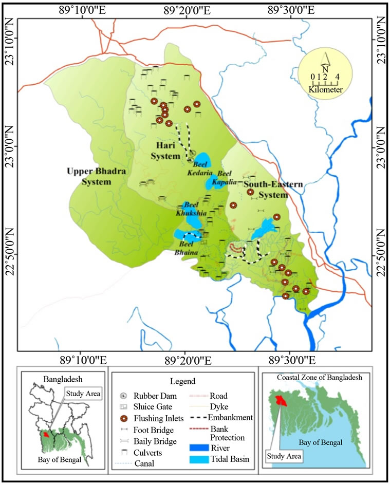
Figure 2. Study area showing different physical interventions implemented under IWRM concept since 1997.
found affected due to water logging at different sub-districts in Satkhira district (located in the West of Khulna) [17].
The study has been developed considering a twofold focus, firstly emphasizing on the positive IWRM impacts in the study area and then establishing some facts on TRM. The impacts would be helpful in clarifying the need of IWRM in regions possessing complicated water management and livelihood groups with conflicting water use. On the other hand, as TRM is an environment friendly, cost effective and economically viable process [18] to raise coastal lands for enhancing agricultural opportunities; the technical conclusions achieved in this study would be extremely helpful in providing TRM planners with information on possible TRM duration, compartment specification and sequence of tidal basin selection.
2. Methodology and Data Assemblage
Environmental impacts of IWRM have been studied using Remote Sensing (RS) technology, Geographic Information System (GIS) tools and Digital Elevation Models (DEMs) as well as statistical analysis of flood levels in the study area. Change in land use and water logging have been analyzed using two satellite images of 2002 and 2012. The satellite images used in this study have been collected from Indian Remote Sensing Satellite Linear Imaging Self-Scanning III (IRS P6 LISS III) and are of 24 m spatial resolution comprising four spectral bands i.e. Band 1 (Green: 0.52 - 0.59 μm), Band 2 (Red: 0.62 - 0.68 μm), Band 3 (Near Infra-red: 0.77 - 0.86 μm) and Band 4 (Mid Infra-red: 1.55 - 1.70 μm). Two separate DEMs (size: 90 rows to 90 columns) of 1997 and 2011 have been used to assess land developments. The DEM of 1997 has been collected from National Water Resources Database (NWRD), Bangladesh and the DEM of 2011 has been collected from Shuttle Radar Topography Mission (SRTM) website. For accurate comparison, all topographic Reduced Levels (RLs) have been converted to Public Works Department (PWD) datum of Bangladesh, referring to a level of 0.46 below the Mean Sea Level (MSL). 50 years’ information (1969 to 2009) on Highest Flood Level (HFL) have been collected at a surface water station of BWDB at Dumuria (22˚47'56.08"N and 89˚25'20.96"E) sub-district, Jessore. Gumbel’s probability distribution, one of the most widely used functions for extreme values of flood peaks [19] has been used for flood frequency analysis. Two flooding scenarios (of 1997 and 2011) have been developed DEM analysis and compared to investigate area’s flood resistance.
Impacts on food security have been studied through assessing the changes (from 2002 to 2012) in cultivable lands, per capita food production, cropping intensity and irrigation coverage. Community based and agricultural information has been acquired from in-situ Rapid Rural Appraisals (RRAs), Focus Group Discussions (FGDs) and Key Informant Interviews (KIIs). Institutional and demographic information have been collected from subdistrict head quarters and Bangladesh Bureau of Statistics (BBS) website.
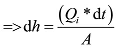
A mathematical formulation has been made using a set of geometric equations to quantify the rate of entry of Suspended Sediments (SS) in any basin due to TRM operation. If dh is the differential stage of tidal water in the basin (from basin bed) at a differential time dt, the differential tidal prism can be written as , where A is plan area of tidal basin.
From definition of flow, mean tidal discharge in a season can be computed as, 
 (1)
(1)
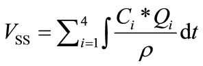
Mass of SS of the tidal prism would be,
 where Ci is the mean Suspended Sediment Concentration (SSC). Therefore, differential volume of SS entering the tidal basin is,
 (2)
(2)
where r is the density of suspended particles.
Putting dh from Equation (1) to Equation (2) we get,
 (3)
(3)
Integrating Equation (3) for the time duration “t” of TRM implementation in one season, the volume of SS entering the basin during that season can be computed and then summing up these values for four different distinctive seasons we get the total volume of SS entering the basin during TRM implementation,
 (4)
(4)
This far, TRM has been implemented at three tidal basins of Jessore district locally named as Beel Bhaina (1997 to 2001), Beel Kedaria (2002 to 2005), Beel Khukshia (2006 to 2013) tidal basin respectively (Figure 2). Beel Bhaina underwent the first large scale TRM operation [20] from October 1, 1997 to December 31, 2001 and tidal water was allowed to enter the basin from Hari River twice a day (during high tide). The basin covered an area of 770 ha (computed from satellite image). In this study, the theoretical entry of sediments during TRM operation in Beel Bhaina tidal basin has been computed using Equation (4). Afterwards, from two DEMs of the same place and time (generated from NWRD and SRTM), an actual value of sedimentation has been determined. Comparison of the theoretical and actual values has provided an understanding of sedimentation percentage achieved due to TRM.
3. Impacts of IWRM
3.1. Water Logging and Land Development
From satellite imageries of 2002 and 2012, changes in three major land use classes (open water, agricultural land and settlements with homestead vegetation) have been measured (Table 1 and Figure 3). A substantial portion of open water areas have significantly reduced and converted to agricultural lands as well as settlements with homestead vegetation.
The information provided in Table 1 reflects developments in land use, agriculture, and socio-economy of the area and most of it has been achieved due to implementation of IWRM concept. In last ten years (2002 to 2012), extent of open water in the area has decreased by 70.13%, recovering around 6 thousand hectares of land for cultivation and settlement purposes.
A separate analysis has been carried out to observe the changes in water logged areas from 2002 to 2012 (Figures 4 and 5). Due to effective implementation of IWRM, the capacity of drainage channels have increased and water logging problems in the area have been solved
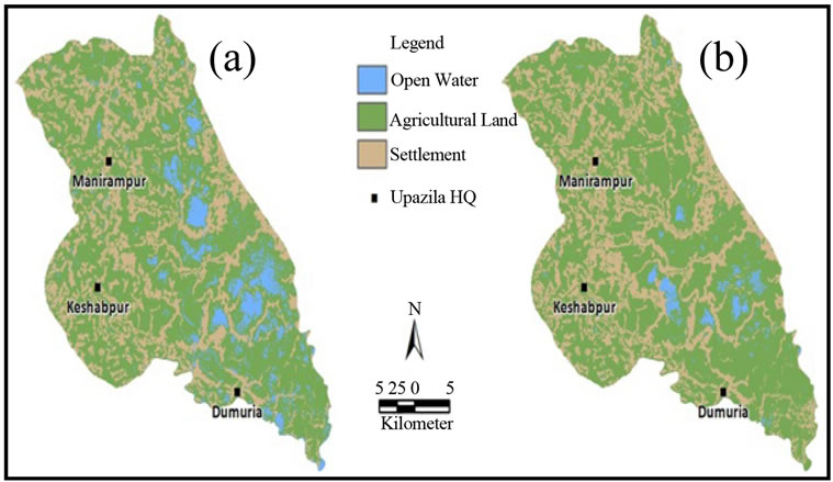
Figure 3. Land use comparison (a) 2002; (b) 2012.
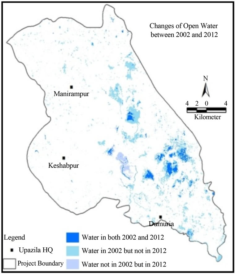
Figure 4. Changes of open water from 2002 to 2012.

Table 1. Land use change in study area.
significantly.
About 6.64% of open water areas vanished in 2012. This was due to the land development works as well as improved river capacities of the area due to IWRM implementation.
Figure 6 explains changes in land elevations on different parts of the study area from 1997 to 2011. In 1997,